magazines
my city ISSN 1982-9922
156.04 Matias Barbosa MG Brasilyear 13, jul. 2013
abstracts
português
O município de Matias Barbosa está elaborando seu Plano Diretor. Nos dias de hoje, além da definição de um moderno distrito industrial com estabelecimentos industriais e de serviços, o município tem ações voltadas para o incremento do turismo.
how to quote
LIMA, Fabio Jose Martins de. Past and present. On the Caminho Novo’s itinerary. Minha Cidade, São Paulo, year 13, n. 156.04, Vitruvius, jul. 2013 <https://vitruvius.com.br/revistas/read/minhacidade/13.156/4822/en>.


The municipality develops its Master Plan, on the Municipal Planning Journeys in covenant with the Federal University of Juiz de Fora. The origins of this city refer, in 1709, the Portuguese Matias Barbosa da Silva a letter of allotment bordered by the Paraibuna river between "the fields of Simao Pereira and Antonio de Araújo." For this exchange, he he committed himself with the Portuguese Crown to support the “Caminho Novo” to travelers. So, were built at first a farm with stables and other facilities for travelers and drovers. The farm was named “Nossa Senhora da Conceição” which was to be adopted for the city (1). The character Matias Barbosa was a frontiersman and great potentate, having died in Vila Rica, in the year 1742. After the death of Matias Barbosa, his farm was sold to Colonel Manoel do Valle Amado, Commander the “Caminho Novo” patrow and head of the Alferes Joaquim José da Silva Xavier – named Tiradentes.

Inviting the participation in the Master Plan process
Divulgação
With the installation of the “Registro do Caminho Novo” in 1752, around the farm emerged other properties, which led to the village. There the "Nossa Senhora da Conceição de Matias Barbosa"’s chapel built in the farm lands has become a reference for travelers. Another reference the "Registro" mentioned, which was established control over those that shaded the mining region, in addition to the collection of taxes on gold and diamonds, and other precious minerals and commodities. Thus, Saint Hilaire relates, "there always weigh up the dry goods entering the province of Minas [...]. As for taxes on net, they pay due to the volume [...]. Anyway, in addition to these rights, it is still paying on the “Registro de Matias Barbosa”, new sum, [...] by slaves recently arrived. The income of this record is a considerable part of the revenue of the Province of Minas, and rises annually". On the conformation of this place in the Southest of Minas Gerais, around the “Registro”, "the buildings occupied by this office form a quadrilateral elongated, and are built around a courtyard big enough to cut the road. Not belong to the government, but an owner that leases and reserves to himself a part. Include housing commander and civilian employees where they weigh the goods, and, finally, another piece of the first neighbor, and also open, which makes the inspection". The high prices were charged with tax reason complaints, after all, "no other province is subject to taxes as high as they pay for themselves in Matias Barbosa. This part of Brazil passed for richer, and on it was that the yoke of colonial rule should weigh more" (2).

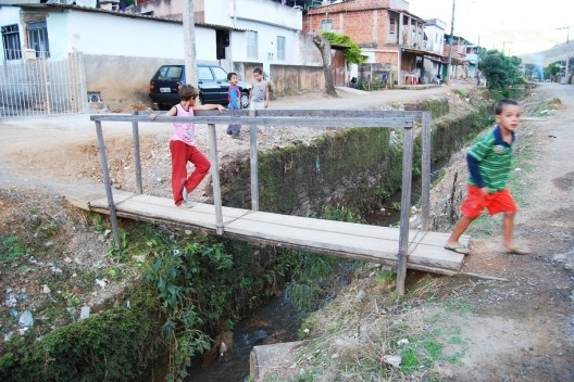
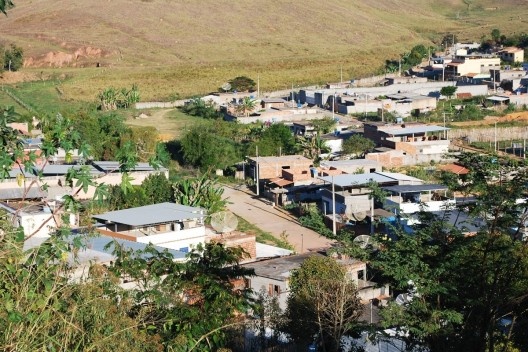
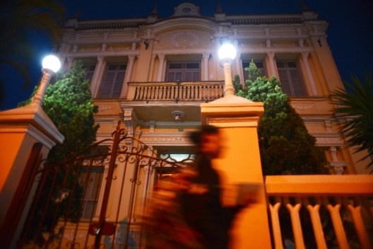
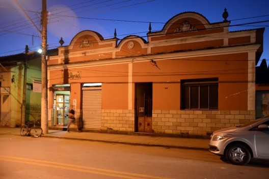
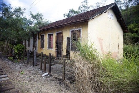
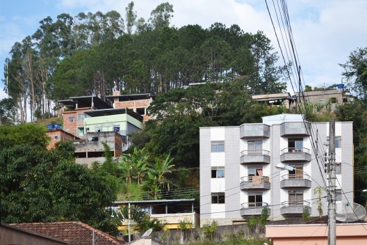
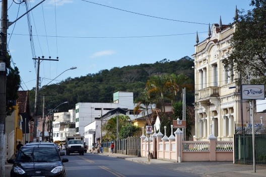
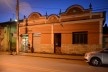
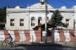
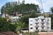
Aspect of the neighborhood Monte Alegre, in Matias Barbosa
Foto Fábio Lima
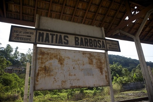
The village of “Nossa Senhora da Conceição de Matias Barbosa”, was elevated to district alone the city of Juiz de Fora, in 1886. In 1911, the district was renamed just Matias Barbosa, and under that name, was elevated to municipality in 1923. At the origin of the formation of the county have the opening of the “Caminho Novo” or the “Caminho Novo de Garcia Rodrigues Paes”, opening this thought even in the Seventeenth Century, in the year 1699, as one of the itineraries link between Rio de Janeiro and Minas Gerais. The authorization to open a new path to Minas Gerais, favoring one of the axes of penetration in the state, was intended to shorten the route to transport gold and other commodities. This authorization came from Lisbon to have been received by the Governor of the Province of Rio de Janeiro, Arthur de Sá Menezes (1697-1702), with the opening of the road was only achieved by around 1707, by Garcia Rodrigues Paes, son of pioneer Fernão Dias Paes, extending from the city of Rio de Janeiro to the mining region, passing “Vila Rica”, and from there to the “Arraial do Tijuco”, current “Diamantina”. In this sense, the construction came in the first years of the Eighthteen Century linking Rio de Janeiro to the region of the mines. Thus, the Crown attempted to combat smuggling and trafficking of these products in other ways besides shorten the way to the Court.

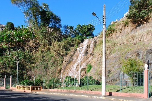
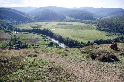
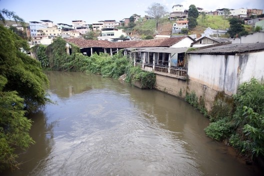
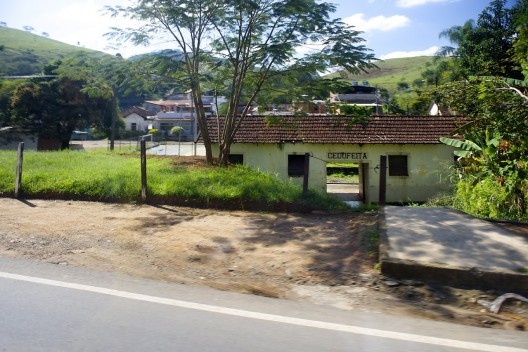
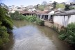
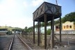
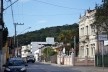
Aspect of the Paraibuna river that runs through the core of Matias Barbosa
Foto Fábio Lima
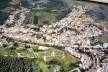
The municipality is located in the Zona da Mata of Minas Gerais, located in the geographical coordinates 21 degrees 51 '54'' South latitude and 43 degrees 19' 35 " West longitude. Matias Barbosa is distant from the state capital, Belo Horizonte about 280 kilometers, near Juiz de Fora, located on the banks of the Paraibuna river with urban development rather than extrapolated its original core. The region was considered a district by the Provincial Law, number 3302 of August 27, 1886, confirmed by State Law number 2 of September 14, 1891. In 1923, the State Law number 843 of September 7, created the city of Matias Barbosa, raising the seat of the district of the same name to the village and attaching the new council districts Santana do Deserto and São Pedro de Alcântara, both dismembered by Juiz de Fora city. However, until the creation of the district of Matias Barbosa, on December 27, 1948, the city was part of judicially and administratively of the city of Juiz de Fora.
According to data from the IBGE census 1950 the municipality had 12632 inhabitants, a decrease occurring later this year, which can be explained by the breakdown of Santana do Deserto. In this period, trade in Matias Barbosa was mostly done with Juiz de Fora and Rio de Janeiro. The population of the municipality had fourteen shops and also retailers with a correspondent bank. In the 1970’s year, the population was estimated at 8788 inhabitants, in actuality, according to the 2010 census count was 13435 inhabitants. The main economic activities in the region in 1950 were agriculture, livestock and forestry.

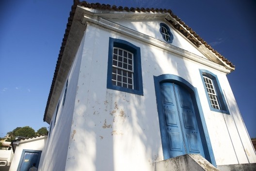
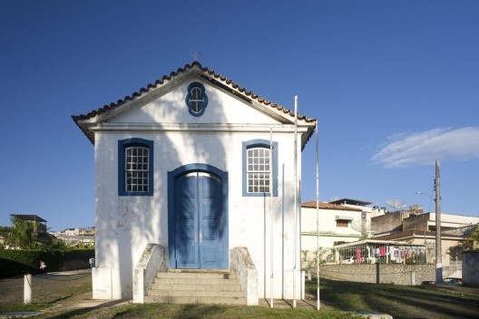
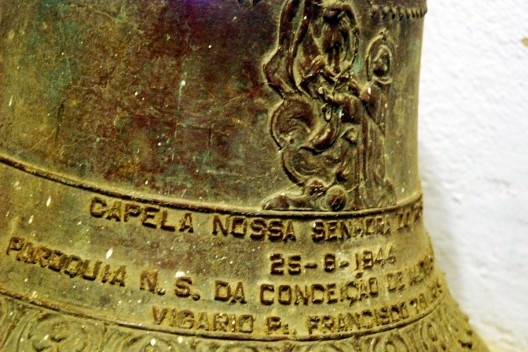
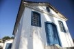
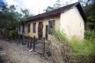
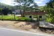
Detail of coverage on tiles of the Capela Nossa Senhora do Rosario
Foto Fábio Lima
Nowadays, besides the definition of a modern industrial zone with industrial establishments and services, the municipality has actions aimed at increasing tourism. Activities related to real estate, rural tourism, livestock, agriculture, trade and crafts mark the life of the city. The insertion of the municipality in New Tourist Circuit “Caminho Novo” contributed to the increase of tourist activities (3). In this process, new expansions configured for subdivisions and condominiums are changing the dynamics of the city and imposing challenges for municipal administration. Among these the needs of a master plan should take into account the municipal participation, as recommended by the Federal Law number 10.257 of July 10, 2001, "approved by law (as) [...] public policy basic instrument to urban development" (4). In this regard, it is noteworthy that even with this law, "the master plan should encompass the municipal territory as a whole [...] (and ensure) in the process [...] and monitoring of its implementation, the Legislative and Executive municipal guarantee: I – the public hearings and debates with the participation of the population and associations representing various segments of the Community II – publicity concerning the documents and information produced III – access to any interested party documents and information produced" (5).
In this sense, the participation process triggered for elaboration of the municipal Master Plan began from the Municipal Conference held on May 24 this year. Activities related to the master plan to follow the empowerment of the working group linked to the Federal University of Juiz de Fora, through the term covenant established with the Municipality. Following the researchs on the reality of the municipality involve professionals and public servers linked the City and the community in its various regions, since the seat until urban neighborhoods, districts and isolated rural areas. It is worth mentioning in this planning process, the importance of understanding on the part of citizens in relation to places, particularly in those places where they live, to a greater awareness of the need for conservation and preservation of the cultural heritage. In this regard, the time involved communities they become protagonists of planning proposals. And thinking about the current development, to reverse urban and rural problems and allow the permanence of cultural identity is through manifestations related to the cultural heritage. Parties, celebrations, artistic skills, edifications, arborizations and gardens, streams and rivers reveal local specificities as tourist potential to be exploited for the communities. Other issues arise such as public transport, urban mobility and circulation, the health, the education, tourism and cultural heritage already mentioned, the public safety, the economy... including solidarity, infrastructure, among these last the question of the wellssprings of water to be unpolluted. Anyway, it puts the prospect of joint formulation of guidelines to reverse the undesirable current degradation... and that through a management participative master plan ... is what we have sought about!!!

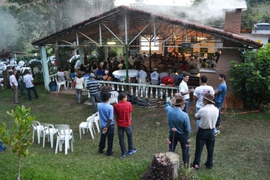
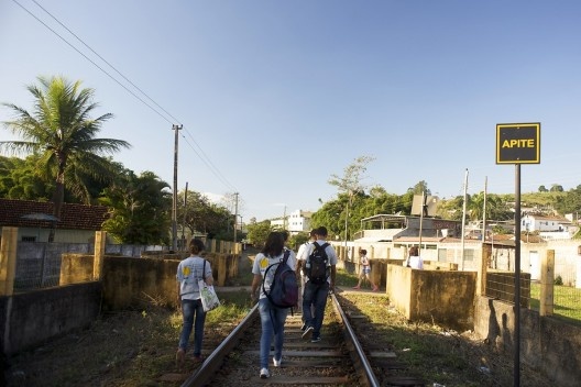
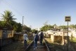
Workgroup Urbanismomg/UFJF in the office of the Master Plan in Matias Barbosa MG
Foto divulgação
notes
1
On the date of the installation of the “Registro” found differences according Moacir Silva is the reference year 1801.
2
SAINT-HILAIRE, A. Travel through the provinces of Rio de Janeiro and Minas Gerais. Belo Horizonte, Rio de Janeiro: Itatiaia, 2000, p.50.
3
The Association of Tourist Circuits set up by nonprofits that characterize the public policy of Tourism Regionalization of Minas Gerais, located by the State Government in 2003, through Decree Law No. 43,321. The Tourist Circuit Caminho Novo gets its name by bringing together cities that have affinity to this itinerary, even in the eighteenth century, to facilitate the transport of gold from Minas Gerais to Rio de Janeiro. The layout of the Caminho Novo, as part of the Royal Road project formulated in 2001 by the Instituto Estrada Real da FIEMG, is marked by concrete milestones that indicate the direction you should follow and have a bit of local history.
4
See: Federal Law number 10257, of July 10, 2001, that "regulates the arts. 182 and 183 Federal daConstituição establishes general guidelines of urban policy and other measures".
5
See: Federal Law number 10257, of July 10, 2001, op. cit.
about the author
Fabio Jose Martins de Lima, Professor at Federal University of Juiz de Fora, from 1999, graduated in Federal University of Minas Gerais (1989), Master in Architecture and Urbanism at Federal University of Bahia (1994) and PH.D. in Architecture and Urbanism at University of Sao Paulo (2003). Between 2011 and 2012 is committed to the Università IUAV di Venezia on a Technical Stage, with support from CAPES, Brazil. In Juiz de Fora coordinating research group Urbanismomg at Federal University of Juiz de Fora, with support of CAPES, CNPq, FAPEMIG and Min Cidades and Culture. In Juiz de Fora coordinating research group Urbanismomg at Federal University of Juiz de Fora, with support of CAPES, CNPq, FAPEMIG and Min Cidades and Culture.