

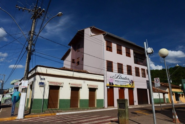
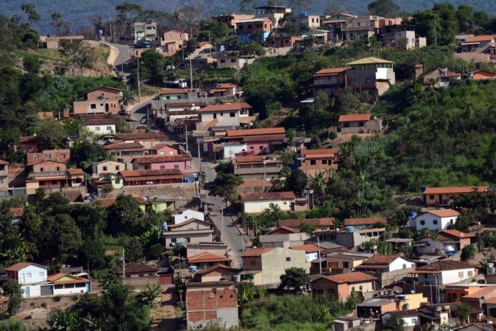
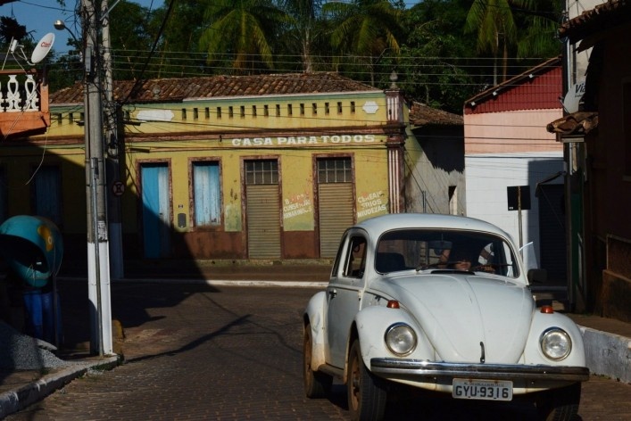

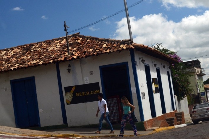


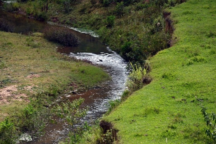

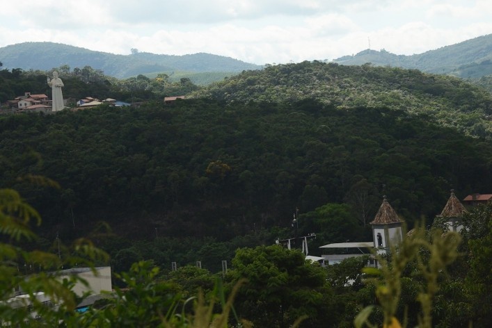


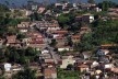


São Gonçalo do Rio Abaixo, with about 10,488 inhabitants, in Minas Gerais, is certainly a city to live. The organization of the municipality, which has 363.828 km2area is shown by the day-to-day, in the bucolic appearance, with pleasent streets and accessible roads, trees and landscaping simple ones, in well maintained heritage and the very hospitable people. In dominant hill, adjacent to the city center the monumental statue of Padre João protects the city against “evil eye”.The main promenade that borders the Santa Barbara River, presents a monumental row of royal palms. The houses consist of original core which refers to the colonial period, in dense urban center, with references that mark the municipal development, from its origins to the present day. In the course of the highways BR's 381 and 262 the Belleus snacks arises as a stopping point with simply culinary reference for those who come and go towards Belo Horizonte to Vitoria. In addition to this center, the plot spans expansions that reveal new occupations, such as neighborhoods and condominiums and an incipient vertical buildings with 4-5 floors. In rural areas also fall within urbanized districts with organized equipment and infraestrura, Água Limpa, Águas Criminosas, Bexiga, Bom Sucesso, Borges, Cachoeira do Carmo, Café Nacional, Canjica, Carrapato, Chácara Velha, Coelhos, Demanda, Fernandes, Gabriel, Gralhos, Machado, Mãe d’Água, Martins, Matias, Monjolo, Morro das Almas, Passa Dez de Cima, Pau de Raio, Pedras, Pena, Placas, Ponte Coronel, Recreio, Rio Claro, Roque, São José, Santa Rita de Pacas, Serra da Vassoura, Una, Vargem Alegre, Vargem da Lua, Jurubeba (Bamba), Terra Branca and Timirim.

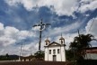
The Cruzeiro in the community of Recreio
Foto/Photo Fabio Lima
The municipality is included in the Metallurgical Zone of the State of Minas Gerais, Brazil, specifically what is meant by Iron Quadrangle of the state, this consists of interconnected mountains that make up splendid landscapes, with relief that resembles the shape of a square and abundant sources of iron ore. Located approximately 84 kilometers from the capital, Belo Horizonte, with main access by Highways BR 381 and 262, old Parallel 20, the first course in the Northeast and the second in the direction of the city of Vitoria in the state of Espírito Santo, with numerous other possible connections other regions of the state. Other link roads fall as the MG 129, whose construction dates back to the period between the years 1922 and 1925, which connects with the city of Itabira, with route leading to the South and the North State. Still puts the MG 434 which has loop that runs through the city's Northwest making the connection on one side, with 381 and 262 and on the other hand, with the municipality of Itabira. Still, 20 kilometers from the urban center stands out the course of the Railway Vitória-Minas, rail link between Belo Horizonteand Vitória, with heavy cargo transportation and with passenger transport activity. Also in 1912, the construction of the Santa Barbara Railway Station, near to the city, linked to the extension of São José da Lagoa in Railroad Sabara to Santa Barbara. Later, from 1936, this iron extension allowed the connection with the RailwayVitória-Minas.
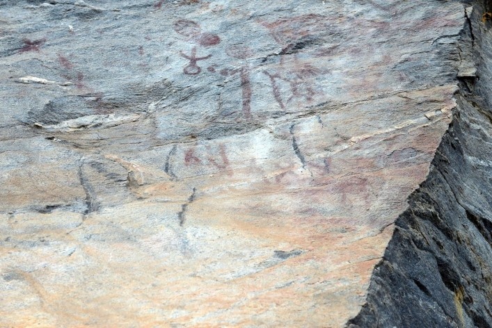
Before the municipal emancipation, by Law No. 2.764, of December 30, 1962, the region was linked to the city of Santa Barbara, located in the South; the Southwest, we have located the municipality of Barão de Cocais. To the north, we have the municipalities of Bom Jesus do Amparo and Itabira; to the east we have the city of João Monlevade; and the Southeast, we have the city of Piracicaba river. In the origins of the so called Rio Abaixo is placed the exploration of gold and other minerals, so abundant in the region that stood out in the eighteenth and nineteenth centuries, in this case, the banks of the Santa Barbara river, mentioned earlier, that winds through the area the city, dividing the urban seat in two parts. Even in 1702, in the eastern of Caraça Hills were rich gold mines discovered that later were called Catas Altas. In this region, decades later, in 1744, was implemented a college assembly Caraça, currently as cultural heritage, not as school, where passed important characters of Minas Gerais. Around 1710, the first explorers arrived in the region, beginning the arraial, with the first raised buildings, having been erected initially shelters as villas and farmhouses, and sugar cane mills and religious buildings. Through trails and drovers paths along the rivers simple houses were built. The documentation of the cathedral dates back to 1733, “the nine leagues of Mariana and eighty of the Court of Rio de Janeiro ends in the Caeté village, Sabara County, (...) (having) the São Gonçalo Cured Chapel river Below (...) 1159 souls” (1).

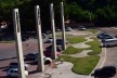
Staircase aspect array access with Coreto on the top
Foto/Photo Fabio Lima
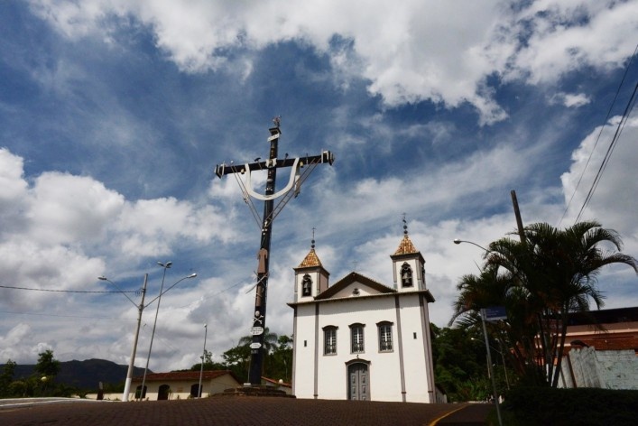
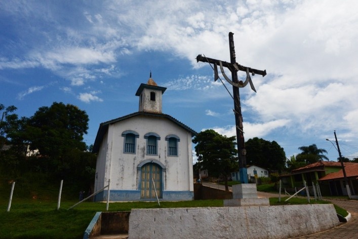
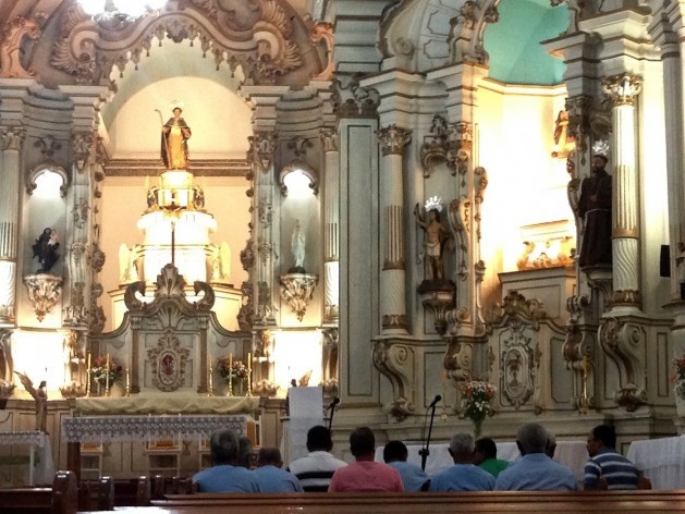
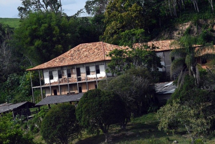
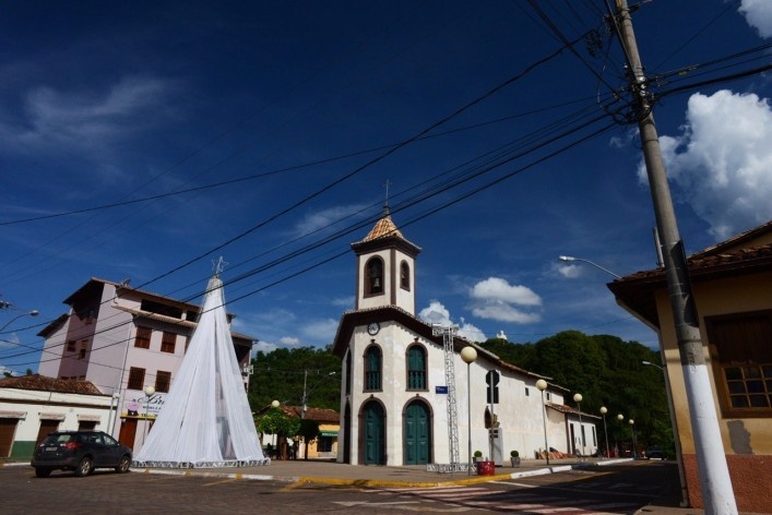
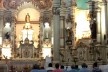
The Church has imposing party, with central portal and two towers with bells, and in the churchyard a Cruise, richly ornamented, built in 1871, with a cross of 17,5 meters tall. One of the bells of the Matrix, with successive friezes and inscriptions, is assigned to the artist Angelo Angeli. Another religious building of the period refers to the Rosary church, located in the urban center of the city, linked to the brotherhood of Nossa Senhora das Mercês da Redenção dos Cativos, founded approximately in 1787. The construction of the simple lines church with bevel, dates back the period prior to the year 1733, with central portal and single tower. Another reference of religious heritage for the city refers to the simple Chapel of Santa Efigenia, which dates back to 1945, also with central portal and single tower, with small churchyard, located on top of a hill. Even in the last decades of the nineteenth century, a chapel was built in the town of Capão, at the request of the local community, in rural municipality, town whose name was changed to São Sebastião de Vargem Alegre. The chapel has large churchyard, built in brickwork and roof ceramic tiles, with central tower and home, led one cruise. In 1792 was erected old Farm Brejaúba of monumental size, also known as the Solar dos Pena, related to the family of Afonso Pena, who was president of Brazil. Initially, the farm had only one deck with cover four slopes and an allusive chapel to Nossa Senhora do Carmo.
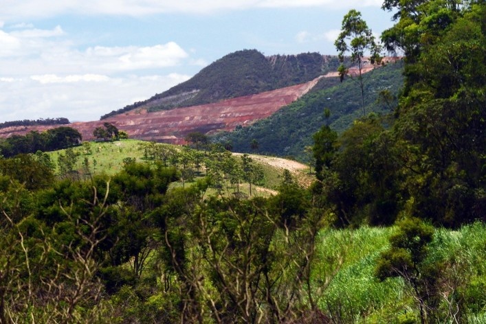
Throughout the nineteenth century, were installed in the region small iron castings, as an announcement of what would later with the exploration of iron ore, which is one of the great riches of the region. Nearby, in the Arraial of São Miguel of Piracicaba, later linked to the city of João Monlevade, Frenchman Jean Antoine Felix Dissandes of Monlevade, graduate engineer from the Ecole Polytechnique in Paris in 1812, who came to Brazil still in 1817, installed a iron factory, whose purpose was the manufacture of tools, hardware and tools for local consumption, such as hoes and horseshoes, sickles, axes, knives, hammers and even agricultural machinery and engines. The enterprise prospered for a period, reaching around 1854 expressive production, going into decline later with bankruptcy declared after the death of its founder. There would be installed a new city, in 1934, by the Belgo Mineira Company. Currently, in the municipal territory of São Gonçalo Brucutumine's managed by Companhia Vale do Rio Doce - CVRD, was inaugurated in 2006. This mine has the largest iron ore production capacity in the world, with projections of 30 million tons per year. In this regard, it is worth mentioning the industrial development of the region, with major companies, besides the Vale do Rio Doce, as Arcelor-Mital, former Belgo-Mineira, Usiminas, Acesita and Gerdau. We should also point Cenibra, on the transform planted trees. On the one hand, these companies bring jobs and a great technological progress, on the other hand, significant environmental interference, which result in large changes in the cultural landscape.

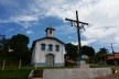
The Chapel of Santa Efigenia
Foto/Photo Fabio Lima
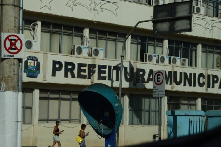
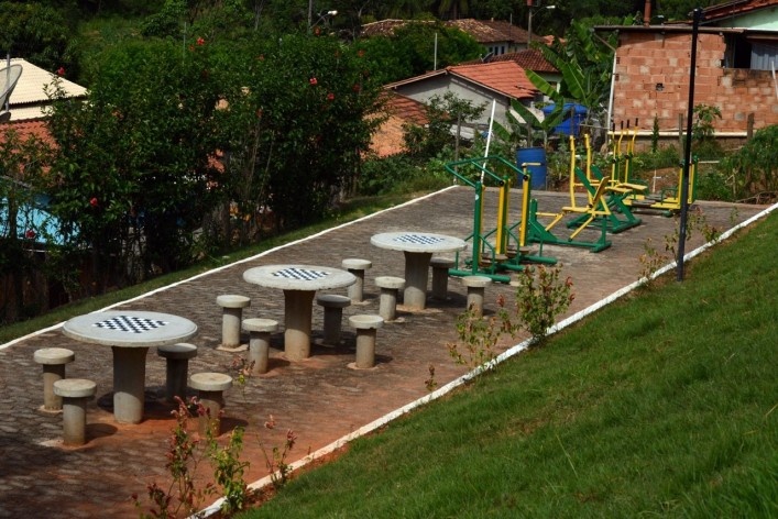
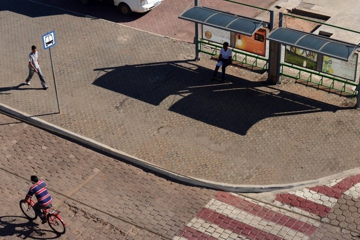
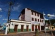
Today, contemporary buildings share space with the remnants of the colonial past, which remained as fragments of the past, distributed by the urban center and the districts and rural areas. Public policies have been developed with continuity and participatory involvement of communities, on several fronts, such as Health, Environment, Education, Culture, Social Assistance, Housing, the Urban Infrastructure and the Social and Economic Development. It is worth mentioning the preparation of the Master Plan in 2006, which review projects for this year 2015, and the Law of Use and Occupation of Urban Land, as existing instruments to support municipal public administration. Among the improvements and investments that stand out, a new organization chart of the Municipal Administration was implemented from 2004, the construction of the Cultural Center, as building adjacent to the City Hall, the deployment of Central Square, Exhibitions Park and the Municipal Funeral, and Housing, Full Time Schools and Basic Health Units and the Municipal Hospital, and Poliesportive Gymnansiums, and Municipal Stadium under construction, and the restoration and conservation of cultural heritage, as well as the paving of municipal roads and the improvement of urban infrastructure. Were also built two industrial districts. Added to these physical appropriations arise cultural agendas, sports and leisure, as well as support to farmers and skilled workers and communities through courses and workshops. Religious celebrations, such as Semana Santa and events such as cavalgada and the Rodeio fest compose the festivities frame.
It is also worth noting that, with the arrival of Companhia Vale do Rio Doce the city had expanded their income with part of the profit transfers to the municipality, which contributed to these actions with direct benefits for the communities. The current administration presented the government plan recently named "New São Gonçalo" having as the main objective strategic changes to adapt the city to their level of development. Municipal investments were multiplied by the territory, is in its central region, is in the districts and in their regions. The city has a unit of the Serviço Nacional de Aprendizagem Industrial - SENAI, and established collaboration with Presidente Antonio Carlos University - UNIPAC and the Federal University of Ouro Preto.

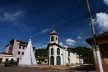
The urban center with the Church in the foreground and the Statue of Padre João in the background
Foto/Photo Fabio Lima
The journey to São Gonçalo do Rio Abaixo is inserted in studies on the formation of cities in Minas Gerais, to understand the planning process and the action of planners. These studies include questions of method and methodology that should not miss the studies on the history of cities and urbanism. Such incursions allow us to glimpse new horizons, particularly to the cities of Minas Gerais, in the perspective of comparative analysis, in terms of thoughts and practices, in terms of their own everyday experience afforded by different urban centers. These approaches allow on cities see different ways for urban and rural development...
note
1
DUARTE, Pe A. A. et al. A teus pés, Senhor!. São Gonçalo do Rio Abaixo, Comunidade Católica da Paróquia São Gonçalo, 2010.
about the authours
Fabio J. M. de Lima is a professor at Federal University of Juiz de Fora.
Jean J. M. de Lima is a Civil Engineer, developing a Master's degree at FUMEC/MG, currently at the Municipality of São Gonçalo do Rio Abaixo / MG.
Natalia R. Fantin is studying Arts and Design at the Federal University of Juiz de Fora.
Olinda L. Dias is studying Law course at FUMEC.
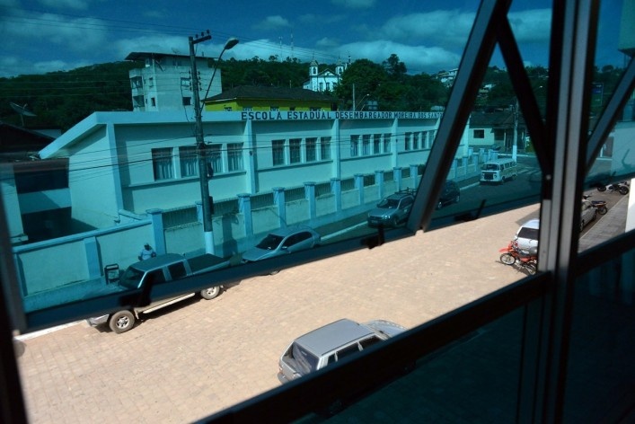
Rafaela C. Torres is studying at the Desembargador Moreira dos Santos’s School, in São Gonçalo do Rio Abaixo.